The GCSE Geology group ventured to Portishead on the Severn Estuary to investigate some key moments in Britain’s geological history.
Our first stop was the Carboniferous sediments at Battery Point. After a detailed inspection of the rocks including abundant fossil debris we concluded (correctly) that they represented cyclical deposition in a marine environment driven by changing sea levels or sedimentary pathways. We then inspected the black rock dolomite and wondered why the formation of dolomite is so hard to explain, why none seems to have formed for millions of years and why it doesn’t react well with acid. No conclusions were forthcoming on any score.
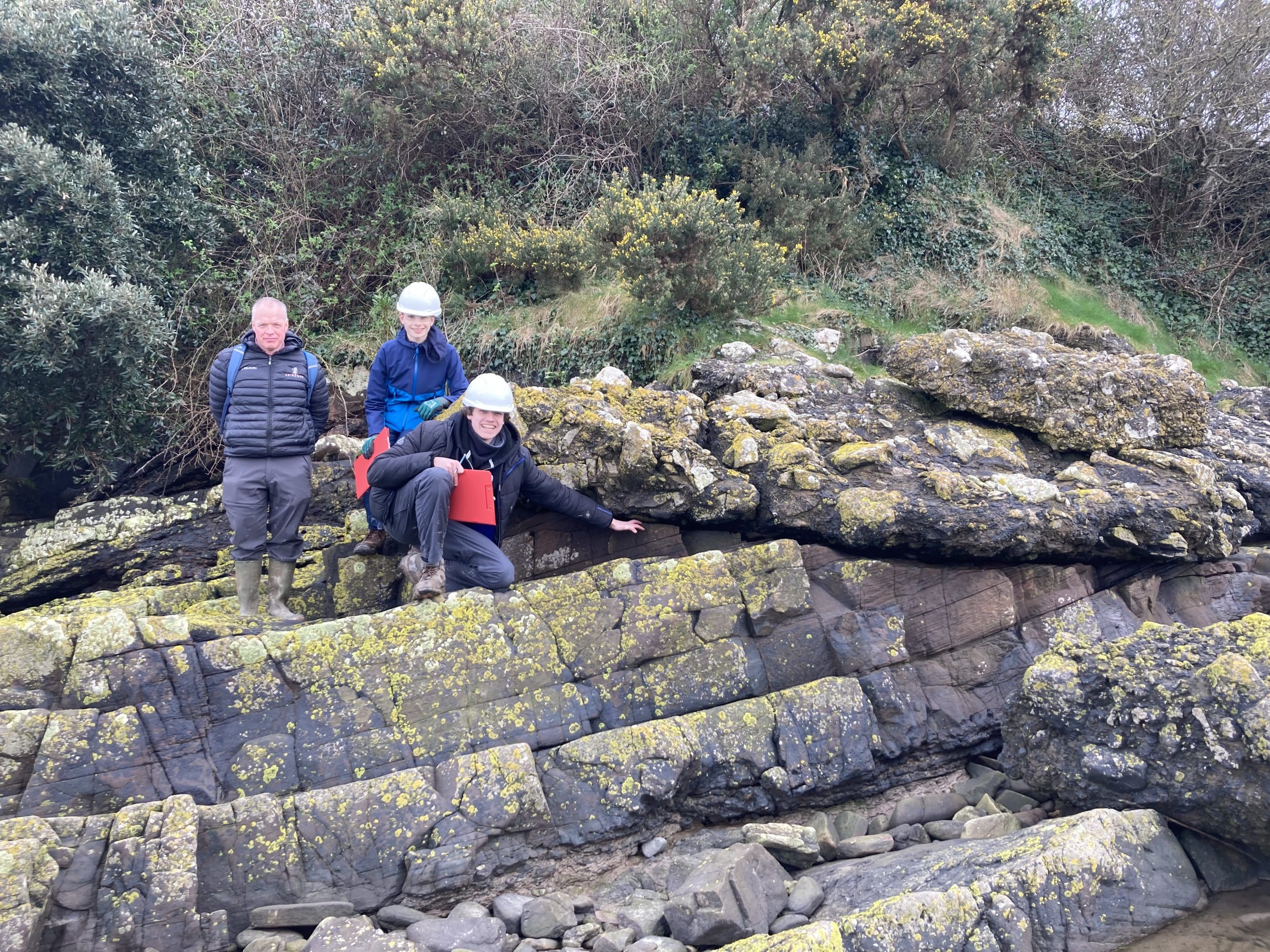
After this, we attempted to map the incredible fold structures exposed in Woodhill Bay recording dips, strikes, dip directions, hinge lies, axial planes and plunge directions. These folds represented the immense compressional forces during the Variscan Orogeny caused by the collision of Gondwana and the Old Red Continent to form the supercontinent Pangaea. The rocks themselves were abundantly fossiliferous siltstones and limestones containing some absolute monster Crinoids, one so big we almost missed it!
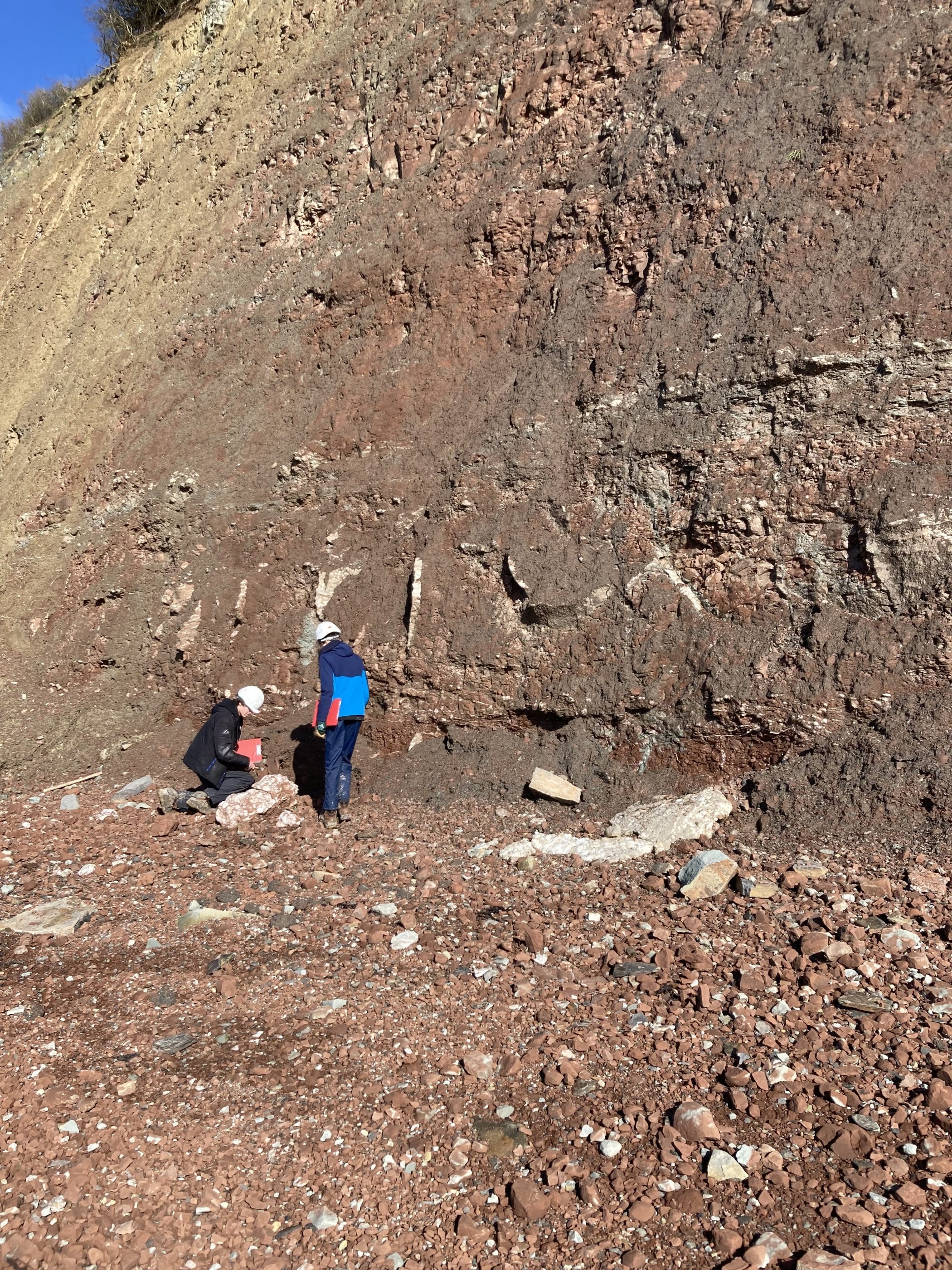
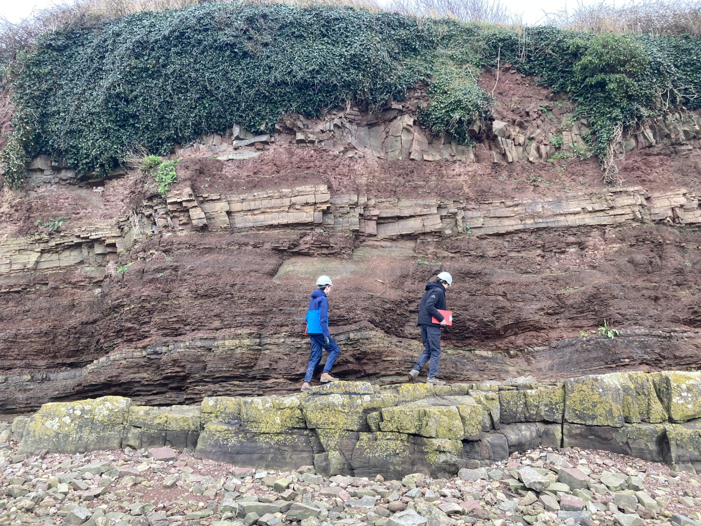
Mapping the folds proved tricky, however, so we broke for lunch and shared Mrs Middleton’s vast chicken pie. Thus fortified, we set off to explore the Devonian exposures of Kilkenny Bay. The Devonian rocks predate the Carboniferous and outcrop all over Britain. It was the first period when England and Scotland were together (following the collision of three plates) as part of the Old Red Continent. Vast rivers eroded the mountains of this land mass to create the distinctive Old Red Sandstones. These are diverse terrestrial sediments and we took pleasure in inspecting many different kinds of rocks and sedimentary structures, including the famous Woodhill Bay Fish Beds (sadly no Devonian Fish were found). We also took the time to sketch two “textbook” geological structures, a post-Triassic normal fault and a spectacular angular unconformity (the best in England??) where a triassic conglomerate (or is it a breccia? We couldn’t decide) sits unconformably on top of dipping Devonian sandstones. While we sketched this, the sun appeared from behind a cloud illuminating the ancient Triassic landscape as surely as it must have done 200 million years ago. “No vestige of a beginning, no prospect of an end” quoted James, as we gazed, giddily, like Hutton before us, into the vast abyss of time.
We returned to the bus after this along with half the mud in the estuary and journeyed to Aust Cliff, next to the Severn Bridge (new one). Here, the very end of the Jurassic (the Rhaetian Stage) is magnificently exposed, desert mud layer upon desert mud layer, until a marine transgression, heralded by shales and limestones in the cliff, flooded the landscape. Ultimately at the top of the cliff, the beautiful Limestone of the Lias is exposed signalling the start Jurassic in Britain. Finally, we inspected the evaporite gypsum veins, found a few fossils including an ammonite and trudged back to the bus with the rest of the mud in the estuary, deserving of a long sleep.